

› long walking distance, exposed to flood during heavy rain
- Fosenhalvøya
 Beds: 8 - available?
 Terrain: forest
 Altitude: 220m
 32V, 0567484, 7078511
 Map: Fosen 113
 Weather forecast: yr.no
 More pictures: here
Source: yr.no
Cabin description
Source: Geonorge
Download PDF map here
There is wood at the cabin, but it is wet and difficult to start a fire with, so we recommend bringing kindling wood.
IMPORTANT INFORMATION:
There are signs on the track marked "NTNUI". These are wrong, and should not be followed.
The correct route is marked on the map to the right, use map and compass to find the way.
The canoe is broken, and can therefore NOT be used anymore.
You have to check the weather forecast before you book the cabin,
because you are depending on crossing the river upstream by foot.
The water level in the lake and the river next to the cabin may rise several meters during heavy rain and/or snowmelting,
making it very difficult to reach the cabin. Thus, there cannot be a lot of rain,
not in the days before nor in the days to come. If there is too much water to wade across the river, you can use the boat which is located on the west side of the river to cross it.
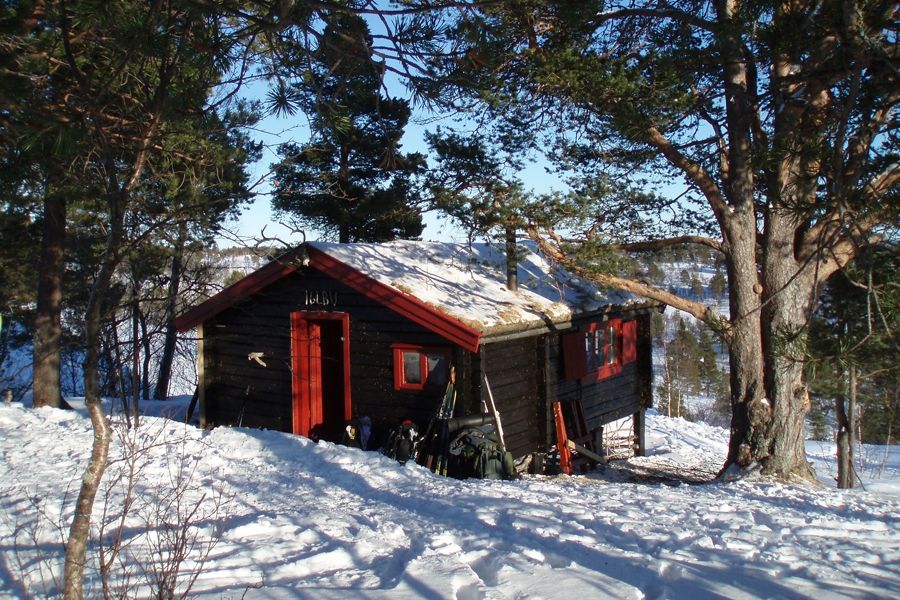
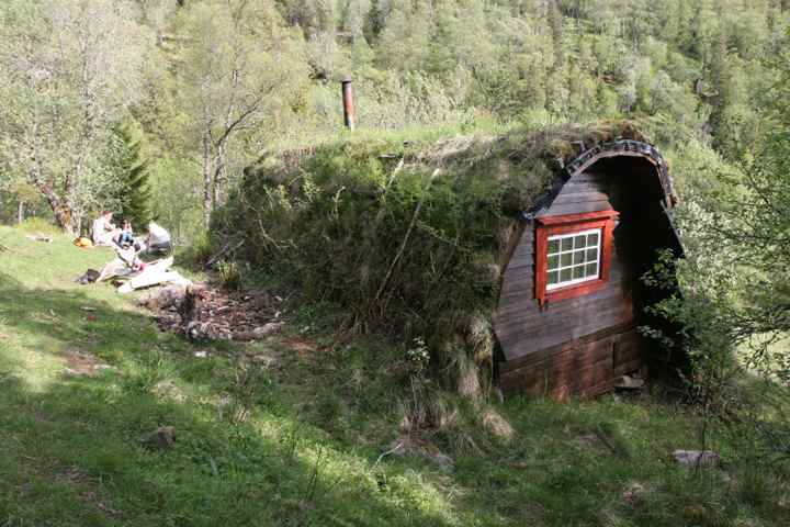
Holvatn is a lake in the middle of Fosen. At the northern end of the lake with a good view you find Holvassgamma, a roomy and comfy comfortable cabin with place for eight.
The cabin was built in 1972 by Danish architecture students who wanted to live in nature for one year. Rumours are that visits to civilisation became more often after a while and the trip was cancelled for good when to of the women were pregnant! The cabin should be demolished after the year, but the Danish students didn't have the heart to do it. That's fully understandable if you come to the cabin!
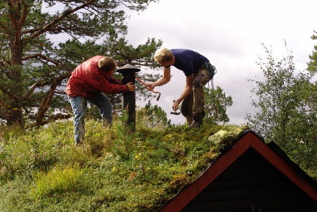
In the following years the cabin was used by local people as basis camp for hunting, fishing, mountain trips... But after a while the cabin needed some restoration which was done by the cabin group when they took over the cabin in 1978 from Statens Skoger. There is a boat at the west side of the cabin.
The houses on this side are leftovers of a farm which was used until the 50s. By that time the farmer's wife didn't want to continue and they moved down to the village. You can also find traces from earlier times - around 1700 there were probably houses at the spot the cabin is placed now.
In all directions there are nice hiking possibilities, you can choose between forest and hills. Skurven, on the south east side of Holvatnet is a hilly area with nice view.
Gjuvasselva at the northern side of the hills has normally a lot of water so it's best to combine the trip with some paddling down the Holvatnet if you don't want to take a bath!
In the Holvatnet (and in other lakes) you don't have to wait for the fish. The best places for fishing are in the northern end of the lake next to Sleppenelva. Also ice fishing is possible. If you want to catch bigger fishes you should try Borttjørnan north for Sleppen, ca. 5km from the cabin (along Sleppelva).
Route description
You can take the Fosenbus directly from Trondheim. It will use the car ferry to continue to Åfjord. In summer it's easiest to start from the south end of Nordsætervatnet, up Litlseterdalen and across Bjørndalsheia. If you wan't to go from here, ask the bus driver, and he will find a suitable place to stop! Up in Litlseterdalen you can often find skiing tracks crossing Svanavatnet and continuing to Holvatnet.
People with car should park at the parking lot south for the bridge to Bjørndalen (not on the map). Be careful - the hillsides at the northwest side of Holvatn are quite steep so it might be better to go down when you can see a small lake (390) at Bjørndalsheia. You have to cross Lysvasselva to come to the cabin. If you follow the river some hundred meters, you can find a good place for crossing. Alternatively you can use the boat but remember to always leave it at the west side of the river!
It's also possible to start from Rødsjøkrysset. In summer you can drive in towards Holvatnet via Litllia. When reaching Avelsgården you can follow the shortest route to the cabin, west for Småtjønnan (not along Holvatnet). The path might be difficult to follow. In winter when the ice is thick you can follow the Holvatnet on the ice.
Extract from the cabin matrix
The table may be scrolled sideways.
| FACTS | Bed places | Table places | Year | Terrain | Bike | Summit trip | Hunting/ Fishing | Guitar | Waffle iron | Specialities | |
|---|---|---|---|---|---|---|---|---|---|---|---|
| Holvassgamma | 8 | 16 | 1978 | F | - | (x) | - | x | x | boat |
| TRAVEL TIME | Private car | Public transport | |||||||||||
|---|---|---|---|---|---|---|---|---|---|---|---|---|---|
| Driving time | Summer | Winter | Trans port | Driving time | Summer | Winter | |||||||
| Walking time | Total travel | Walking time | Total travel | Walking time | Total travel | Walking time | Total travel | ||||||
| Holvassgamma | 2:00 | 3:00 | 5:00 | 3:00 | 5:00 | bus/ boat | 2:30 | 4:00 | 6:30 | 4:00 | 6:30 | ||
| TRANS- PORT | Alt. | Transport | Route via | Exit | |
|---|---|---|---|---|---|
| Holvassgamma | 1 2 | Regionbuss 350 Rissa Regionbuss 452 Åfjord Hurtigbåt 810 Regionsbuss 452 Åfjord | Trondheim - Rissa Rissa - Åfjord Trondheim - Vanvikan Vanvikan - Åfjord | Rissa skysstasjon Rødsjø Vanvikan Rødsjø |
Check The Cabin Matrix for more information and comparison with other cabins.
Parking
Summer time: At Avelsgården (ask for permission) or at the parking place south of the bridge to Bjørndalen.
Winter time: At Rødsjøen or at the parking place south of the bridge to Bjørndalen.

