

› very exposed to weather conditions during winter, very long walking distance
- Trollheimen
 Beds: 6 - available?
 Terrain: mountain
 Altitude: 1180m
 32V, 0514879, 6957008
 Map: Oppdal 98
 Weather forecast: yr.no
 More pictures: here
Source: yr.no
Source: varsom.no
 Snow avalanche forecast Trollheimen
Forecast published: 1. Dec kl.15:32
Next forecast before: 3. Dec, 16:00
 Today Monday 1 December
Not much snow and genreally stable conditions. Smaller slabs of wind deposited snow can be triggered in isolated features.
Special rules for reservation
Kamtjønnkoia is located in an avalanche prone terrain and is therefore only limited available for cabin reservation in winter time. The following special rules apply:
› Cabin is closed at hazard level 3 (+).› The cabin can be closed even after you have booked. This happens when the hazard level increases from 2 to 3 in a new forecast. You will then get a refund and offered another cabin as long as one is available.
Cabin description
Source: Geonorge
Download PDF map here
Very long and challenging route. The area is very exposed to the weather and it can change quickly. This hike is not recommended for groups with little experience.
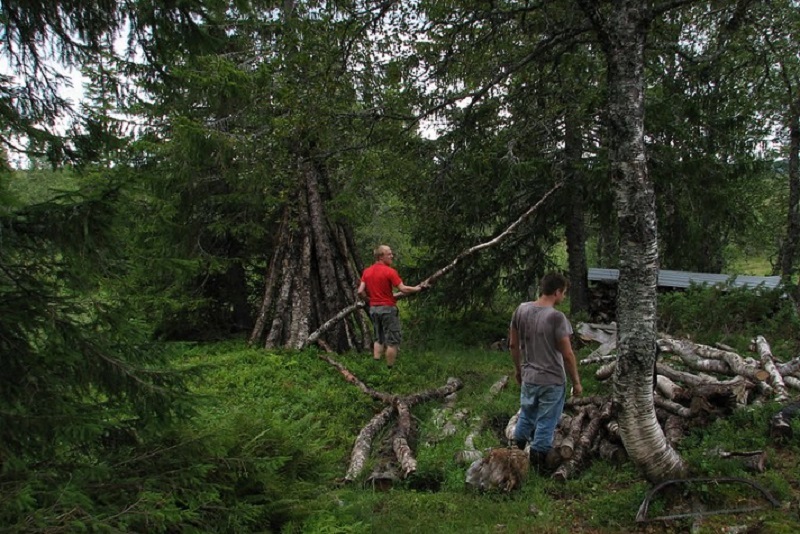
The wood for Kamtjønnkoia is located on the way to the cabin, as marked on the map!
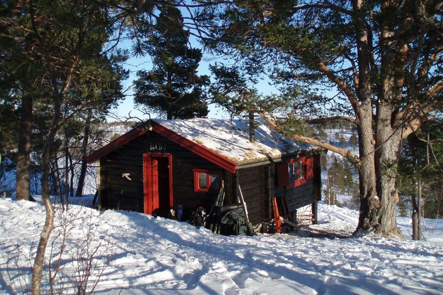
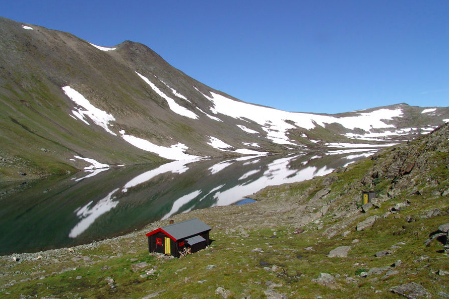
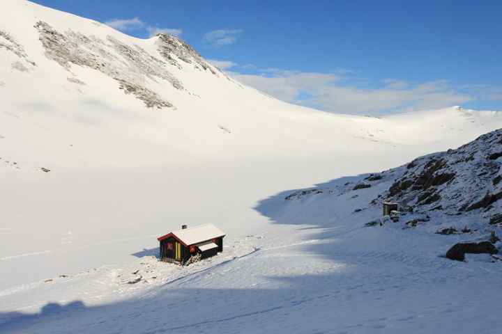
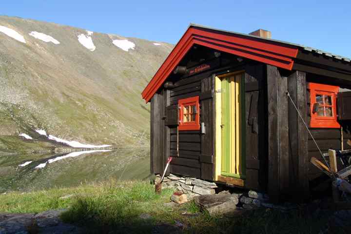
Kamtjønnkoia is probably the cabin with the best surroundings! At least if you like mountains. The cabin is placed at the foot of Blåhøa in the heart of Trollheimen.
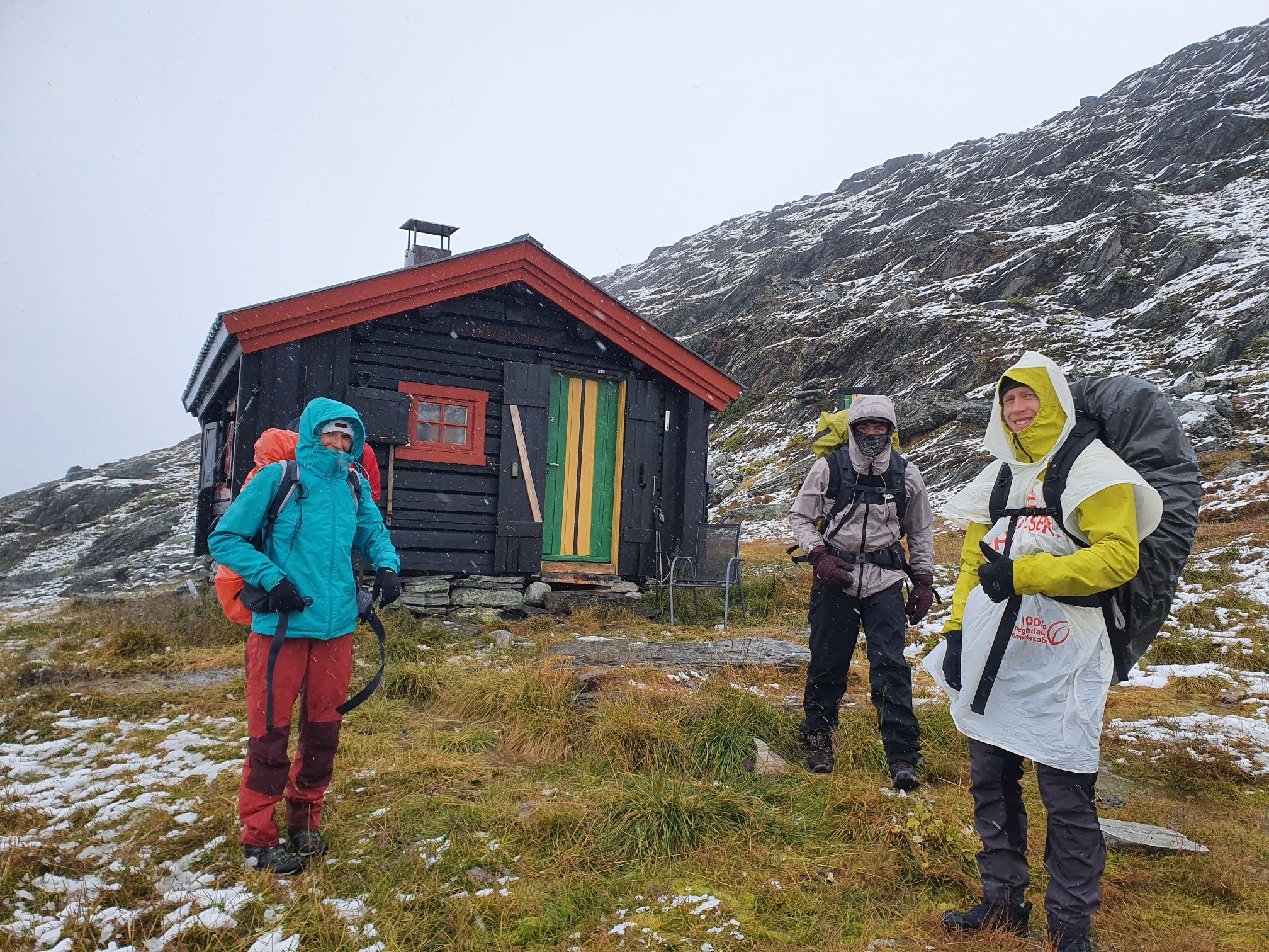
Be aware of that weather conditions in this area can be harsh and you should be familiar with the mountains before planning a trip to Kamtjønn. This is especially important in winter time, since the passage of a narrow gorge about one kilometer from the cabin requires good skiing abilities! Check the weather forecast carefully before you leave for Kamtjønn and be prepared for possible rapid weather changes. Weather conditions in the mountains can be challenging at times!
Kamtjønnkoia became part of the cabin network in June 1993, because the "Vitenskapsmuseet" in Trondheim realized that they could not longer look after a cabin which they didn't use regularly. A cabin fan got to know that and gave a hint to the cabin group in NTHI. They acted immediately and some weeks later an agreement between NTNU Drift and the cabin group was settled. NTNU Drift can still use the cabin if needed, but in the mean time the cabin group takes care of it.
Kamtjønnkoia was built in 1950 as a base camp for scientists studying plants and flowers in the surroundings. Close to the cabin there is a botanical field with some signs telling the names of plants.
For people interested in hiking trips, Kamtjønnkoia is more interesting because it is situated in the middle of Trollheimen. That gives the opportunity to make a trip from connecting Rindalsløa, Telin, Kamtjønnkoia and the huts of Turistforeningen. The cabin is built at 1200 meter and is the highest cabin of NTNUI.
There are many possibilities for mountain trips (Blåhøa, Gjevilvasskamman, ...). The alpine terrain requires good knowledge of possible risk for avalanches in winter time as the mountain sides around the cabin are steep. If you are in doubt about the stability in the snowlayers, don't leave for the mountain top and rather enjoy the sun in front of the cabin! Avalanche warning for Trollheimen can be checked on the web under www.varsom.no. If you are equipped with a modern cell phone, you may check this when you are at the cabin. Best cell phone coverage can be obtained by climbing the small top just behind the cabin. The latter is also important to remember in the case of emergency. In winter time, the cabin can be closed with short notice due to avalanche danger. Due to safety concerns, the cabin can also be closed if it is already reserved. In such cases, the reservation fee will be refunded.
The ski season starts early (October) and ends not before the beginning of June. The ice on the lakes close to the cabin disappears normally in June. Concern the harsh environment if you want to make a trip. There are no trees around the cabin, you have to come down to Gjevilvatnet to find shelter, as for example at Gjevilvasshytta. During the years the cabin has two times been blown from the fundaments. Therefore it is fastened with wires now.
The cabin is not difficult to find because it is lying in a valley on the north east side of a river/lake. The wood is carried up by scooter but since they cannot drive completely in, you have to take some wood from the wood stables to the cabin (even if there is wood at the cabin!). There is a sled in the cabin which you can use for it in winter.
Route description
Kamtjønnkoia lies far away from civilisation. From Oppdal you can take a bus to Sunndalsøra and leave it where the road to Gjevilvatnet is taking off.
From there it is around 20km to the cabin. In summer it is sometimes possible to take a bus to Gjevilvasshytta, and then the trip is around 10km.
By car you can drive in three more kilometres to Gjevilvatnet in winter where you can find skiing tracks in to Gjevilvasshytta.
In summer you can drive a little bit longer than to Gjevilvasshytta.
From there you still have to walk 500m up and around 8 kilometres.
If there is a lot of water in the river you have to cross, you can continue to the north,
were it's possible to cross it without getting wet feed (in a swing with a small island).
If you follow the marked path, you will find a bridge, built in 2022.
About one kilometer before reaching the cabin, one must pass through a narrow gorge at the runout of the lower Kamtjønnin. In summer time, there is a path on the north side of the stream, which is well marked with TT signs. During winter, the passage of the gorge can be challenging. Depending on snow conditions, it can be considered to follow the summer route, or follow the stream upwards, provided that there is enough snow. It might be an advantage to bring crampons in case of icy conditions in the gorge.
Extract from the cabin matrix
The table may be scrolled sideways.
| FACTS | Bed places | Table places | Year | Terrain | Bike | Summit trip | Hunting/ Fishing | Guitar | Waffle iron | Specialities | |
|---|---|---|---|---|---|---|---|---|---|---|---|
| Kamtjønnkoia | 6 | 10 | 1993 | M | - | x | x/x | x | - | ice drill |
| TRAVEL TIME | Private car | Public transport | |||||||||||
|---|---|---|---|---|---|---|---|---|---|---|---|---|---|
| Driving time | Summer | Winter | Trans port | Driving time | Summer | Winter | |||||||
| Walking time | Total travel | Walking time | Total travel | Walking time | Total travel | Walking time | Total travel | ||||||
| Kamtjønnkoia | 2:30 | 4:00 | 6:30 | 6:00 | 8:30 | bus/ train | 2:30 | 7:00 | 9:30 | 7:00 | 9:30 | ||
| TRANS- PORT | Alt. | Transport | Route via | Exit | |
|---|---|---|---|---|---|
| Kamtjønnkoia | 1 2 | Regionbuss 340 Regionbuss 480 Nettbuss 901 NSB Nettbuss 901 | Trondheim - Støren - Røros Støren - Berkåk - Oppdal Oppdal - Kristiansund Trondheim - Oslo Oppdal - Kristiansund | Støren Oppdal Festa Oppdal Festa |
Check The Cabin Matrix for more information and comparison with other cabins.
Parking
Summer time: Parking place ca. 1km along the road to the west from Gjevilvasshytta.
Winter time: At the parking place at Osen in the end of Gjevilvatnet.

