


Lynhøgen

› demanding navigation on the last part, long walking distance from public transport
- Brungmarka
 Beds: 4 - available?
 Terrain: forest/timberline
 Altitude: 532m
 32V, 0585922, 7010162
 Map: Trondheim 106
 Weather forecast: yr.no
 More pictures: here

Source: yr.no
Cabin description
Source: Geonorge
Download PDF map here
One of the neighbouring dogs likes to follow visitors along: But don't worry, he is fully
capable of finding his way back on his own.
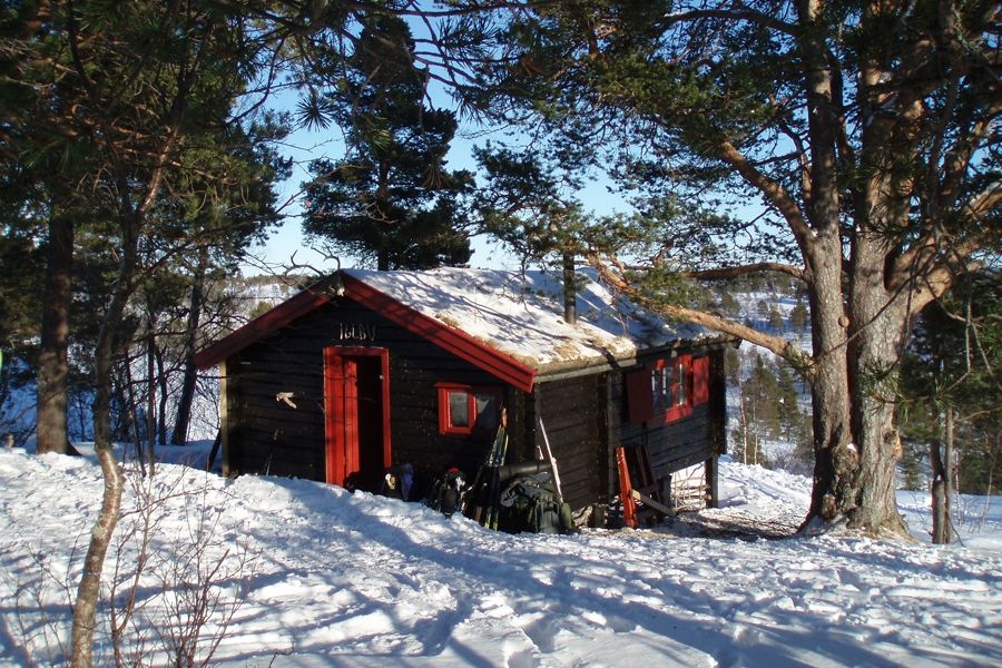
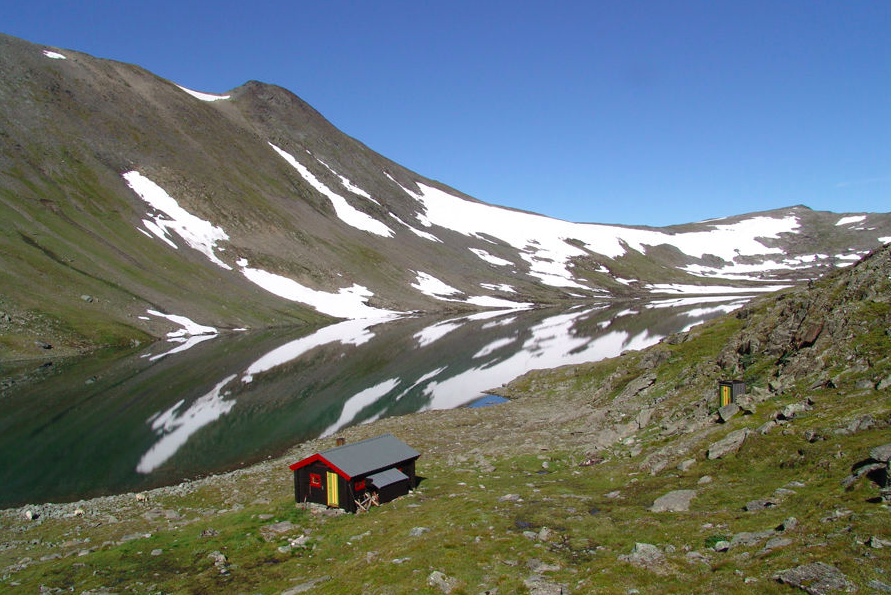
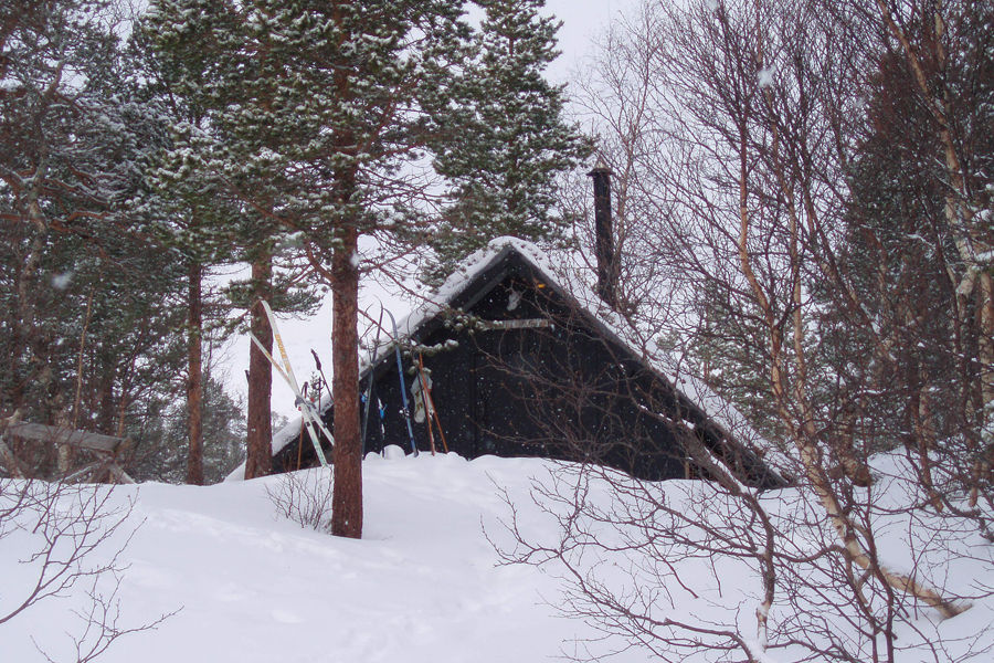
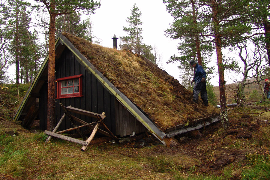
In springtime 1973 the cabin group tried to find a nice place between Selbusjøen and Reinsfjellet. Directly north of the Litlrensjfjellet in Kjønesdalen and ca. ten kilometres south of Selbusjøen they found a proper place for a small cabin. It was idyllic and quiet, just good to welcome stressed students.
The name of the cabin has a funny history, if you want to believe in what is written. It says that at the place the cabin is situated at now was once struck by lightning in 1927. After a heavy thunderstorm a boy found a big birch tree burst into pieces and the boy called the place Lynhøgen (lightning-hill).
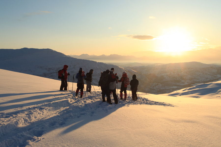
There is nice skiing terrain south of the cabin in the direction of Reinsfjellet (943m). Trips to Kråklikåten and Nicokoia can be recommended. Also Mortenskåten can be reached, but that is a long trip. Be careful with avalanches in the surroundings!
Route description
Motorists are advised to drive to Selbu, take to Vikvarvet and further drive towards Renå. From there you can drive on the toll road until you cross Hornåa, where the road is closed. Contrary to what many maps show, you can continue (walking) along the road all the way to Dalvollen. From here you continue along a small path, which gradually disappears and you have to find your own way the last few hundred meters. In winter, the toll road is closed and you can park at Renå.
You can also take the bus to Brøttem. From here it is around 8 hours to the cabin. From Brøttem there is a road to Tangvollelva ca. 1km south of Moavollen that is closed by a gate. You can not drive past this gate, but it is a good idea to continue on bike, if not continue on foot. Not all busses go to Brøttem, sometimes you have to go from Klæbu, which makes the trip still longer.
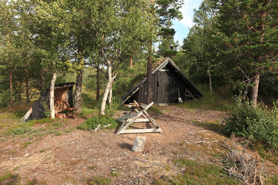
From Tangvollelva you have to go on the north side of Litjrensfjellet. Go in direction of Hornsjøan. To find the cabin you have to find the Kjønesdalen first, there you stay on the western side of the stream. The cabin is not situated on the top of the hill you can see on the map. It's on the southwest side of this hill and you can not see it from the top. You are not looking for a big building, the cabin is fitting quite well with its surroundings.
Extract from the cabin matrix
The table may be scrolled sideways.
| FACTS | Bed places | Table places | Year | Terrain | Bike | Summit trip | Hunting/ Fishing | Guitar | Waffle iron | Specialities | |
|---|---|---|---|---|---|---|---|---|---|---|---|
| Lynhøgen | 4 | 8 | 1973 | F/T | (x) | x | - | - | - |
| TRAVEL TIME | Private car | Public transport | |||||||||||
|---|---|---|---|---|---|---|---|---|---|---|---|---|---|
| Driving time | Summer | Winter | Trans port | Driving time | Summer | Winter | |||||||
| Walking time | Total travel | Walking time | Total travel | Walking time | Total travel | Walking time | Total travel | ||||||
| Lynhøgen | 2:00 | 1:30 | 3:30 | 3:00 | 5:00 | bus | 0:45 | 8:00 | 8:45 | 6:00 | 6:45 | ||
| TRANS- PORT | Alt. | Transport | Route via | Exit | |
|---|---|---|---|---|---|
| Lynhøgen | 1 | Buss 72/73 Buss 83/214 | Trondheim - Klæbu Klæbu sentrum - Bjørkli - Ler | Klæbu Brøttem |
Check The Cabin Matrix for more information and comparison with other cabins.
Parking
Summer time: Parking at the road barrier at Hornåa.
Winter time: Parking at Renå.
Degree of difficulty
| 1) | For beginners. These cabins are easy to find and a road is going all the way to the cabin. You should anyhow be familiar with map and compass. | |
| 2) | For those with some experience. Characteristic for this category is that the cabins are not far from the nearest road and that the terrain is simple to walk in. | |
| 3) | For experienced users. These cabins are situated farther from the nearest road and require good orienteering skills. May be exposed to the weather during winter. | |
| 4) | For ambitious users. What distinguishes these cabins from level 3 is that the terrain is more demanding on the way to the cabin, as well as that they can be hard to find. | |
| 5) | Demanding. The trip requires that you are familiar with the mountains and are well equipped. Long walking distance and weather conditions might be challenging. |